1). “Trump terminates satellite data considered crucial to storm forecasting”, Jun 27, 2025, Chelsea Harvey, E&E News, at < https://www.eenews.net/
2). “Critical Hurricane Forecast Tool Abruptly Terminated: U.S. Department of Defense announced Tuesday it would no longer process and deliver data essential to most hurricane forecasts”, Jun 26, 2025, Michael Lowry, Eye on the Tropics, at < https://michaelrlowry.
3). “Why a NASA satellite that scientists and farmers rely on may be destroyed on purpose”, Aug 4, 2025, Rebecca Hersher, NPR, Morning Edition, audio report 3 minutes long, text version posted at site, at < https://www.npr.org/2025/08/
4). “Trump orders NASA to kill 2 satellites that can function for many more years - the reason will shock all”, Aug 6, 2025, Shreya Biswas, The Economic Times (English Edition), at < https://economictimes.
5). “The perfectly fine, already-paid-for satellites Trump wants to destroy in a fiery atmospheric reentry”, Aug 13, 2025, Andrew Freedman, CNN, at < https://www.cnn.com/2025/08/
6). “Trump admin strips ocean and air pollution monitoring from next-gen weather satellites”, Aug 20, 2025, Andrew Freedman, CNN, at < https://www.cnn.com/2025/08/
7). “White House outlines plan to gut NOAA, smother climate research: The agency’s Office of Oceanic and Atmospheric Research would be 'eliminated as a line office,' according to a memo from the Office of Management and Budget”. April 11, 2025, Daniel Cusick, Chelsea Harvey & Scott Waldman, Politico, at < https://www.politico.com/news/
~~ recommended by dmorista ~~
Introduction by dmorista: The whole MAGA movement, with Trump its nominal leader, is overtly hostile to science with a special grudge against efforts to better understand what is happening to the atmosphere and the environment as a consequence of Global Warming due to Greenhouse Gases emitted overwhelmingly by the rich countries of the world.
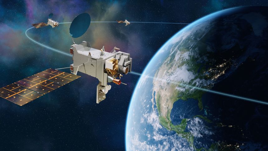
Like a child who thinks they can hide under the covers from something they don't like the Trumpian regime thinks they can just not gather, store, and use data from the satellites and other equipment that the U.S. Government has been operating and had planned to launch and operate. Item 1)., “Trump terminates satellite data ….”; & Item 2)., “Critical Hurricane Forecast Tool ….”, both discuss the abrupt and total cut-off of important data generated by 3 different satellites that generate essential data that makes it easier to characterize the strength of developing hurricanes in the hours of the night.
Item 1). notes that:
“A Department of Defense weather satellite program that collects vital information for hurricane forecasts will stop distributing data products to users Monday.
The termination of data products from the Defense Meteorological Satellite Program could lead to dangerous declines in the quality of hurricane forecasts, meteorologists say. That’s especially worrying, they say, as the termination comes in the middle of this year’s hurricane season.
“ 'There is no sugar-coating it: hurricane forecasts will undoubtedly be worse after this loss,' said Brian McNoldy, a hurricane expert at the University of Miami, in an email to POLITICO’s E&E News. 'For anyone near a hurricane-prone area, this is alarmingly bad news.' (Emphasis added)
“NOAA, which provides operational support for the program, issued a termination notice Wednesday. The agency did not provide reasons for the decision.
“An official for the U.S. Space Force, which manages the program, confirmed that the satellites and their instruments are still fully functional. And the Defense Department will still have access to DMSP data.
“But for the program’s large network of users, the data products are going dark — and it’s still unclear why.” (Emphasis added)
Item 2). agrees with the issues discussed above and furthermore points out that:
“Since hurricanes form and strengthen over the open water where direct observations are scarce or nonexistent, forecasters rely largely on data remotely gathered from satellites. While hurricane hunting airplanes help to close that gap, they’re only available for about 1 in every 3 hurricane forecasts in the Atlantic and virtually none – except for a handful of stronger storm exceptions – in the Pacific. (Emphasis added)
“Traditional weather satellites are helpful, but they don’t allow forecasters to peer beneath the clouds to understand important structural changes that can tip them off to episodes of rapid intensification. At night especially, geosynchronous satellites most familiar to the general public can fail forecasters, often missing important details only seen by visible satellite or critical microwave pictures from polar-orbiting satellites that provide MRI-like scans to forecasters every few hours.
“The Defense Meteorological Satellite Program and its constellation of three weather satellites provide roughly half of all microwave satellite scans to forecasters. Those go dark beginning next Monday.
“ 'Their loss is a big deal,' says retired National Hurricane Center branch chief James Franklin, who oversaw all NHC hurricane forecasters until his retirement in 2017. 'Without this imagery, there will be increased risk of a “sunrise surprise,” the realization from first-light images that a system had become much better organized overnight, but it wasn’t recognized because structural details are so hard to discern from [infrared satellite].' ” ….
“Microwave data such as those from the DoD Special Sensor Microwave Imager Sounder are essential to hurricane forecasts, not a nice-to-have. They’re used in a variety of critical applications, including estimating hurricane intensity through AI-driven neural networks like the Deep Multispectral INtensity of TCs estimator or DMINT. In the absence of hurricane hunters, DMINT has been shown to be one of the most crucial tools in a hurricane forecaster’s arsenal for estimating storm intensity, largely because of the microwave data it utilizes.” (Emphasis added)
The consequences of this particular change, that will have extremely unfavorable effects on Hurricane predictions, will fall most heavily on the Red States of the Southeast, though Blue-leaning coastal areas cities, in those Reactionary States will likely take some expensive hits in the future.
Another outrageous action is the plan to bring down two satellites that are reporting important data on amounts of CO2 in the atmosphere. This is data that the “Global Warming is a Chinese Hoax” Trump does not want being generated anymore. This issue is discussed in Item 3)., “Why a NASA satellite ….”; Item 4)., “Trump orders NASA to kill 2 satellites ….”; and Item 5)., “The perfectly fine, already-paid-for satellites ….”; articles that all report on the move by the Trump Regime to destroy 2 identical satellites that are reporting useful data about levels of moisture. The two functioning satellites (one of which is carried in the International Space Station, and the other is a separate satellite orbiting the earth) and another identical satellite that was destroyed in a launch that went bad cost a total of $750 million and have many years of possible life, reporting important data, left to them.
Finally there are the Trump Regime's efforts to end climate research in the future. Item 6)., “Trump admin strips ….”; and Item 7)., “White House outlines plan ….”, both report on the extensive efforts by the Trump Regime to cut off climate research in the future in NOAA, NASA, and the National Weather Service claiming that the only legitimate areas for research and development are weather forecasting. The Trump Regime has already decreed that the number of new satellites to be launched in the next couple of years will be reduced from 6 to 4, and any capabilities to measure atmospheric phenomena, beyond the most constrained view of what is important, will be removed from the designs.
xxxxxxxxxxxxxxxxxxxxxxxxxxxxx
Trump terminates satellite data considered crucial to storm forecasting
A Department of Defense weather satellite program that collects vital information for hurricane forecasts will stop distributing data products to users Monday.
The termination of data products from the Defense Meteorological Satellite Program could lead to dangerous declines in the quality of hurricane forecasts, meteorologists say. That’s especially worrying, they say, as the termination comes in the middle of this year’s hurricane season.
“There is no sugar-coating it: hurricane forecasts will undoubtedly be worse after this loss,” said Brian McNoldy, a hurricane expert at the University of Miami, in an email to POLITICO’s E&E News. “For anyone near a hurricane-prone area, this is alarmingly bad news.”
NOAA, which provides operational support for the program, issued a termination notice Wednesday. The agency did not provide reasons for the decision.
An official for the U.S. Space Force, which manages the program, confirmed that the satellites and their instruments are still fully functional. And the Defense Department will still have access to DMSP data.
But for the program’s large network of users, the data products are going dark — and it’s still unclear why.
The Navy’s Fleet Numerical Meteorology and Oceanography Center is responsible for processing the program’s data and sending it to NOAA for public distribution, the Space Force official said, noting that questions about the reasons for the termination should be directed to the Navy.
According to a Navy spokesperson, it is” discontinuing contributions to DMSP given the program no longer meets our information technology modernization requirements.”
DMSP has operated since the 1960s. It’s a constellation of weather satellites collecting a variety of measurements used to track everything from thunderstorms to fog to snow and ice cover. Its data products are used by researchers around the world, including forecasters at the National Weather Service.
‘Insanity’
One of the program’s key capabilities is its specialized microwave sensor. This instrument provides detailed scans that allow scientists to effectively see through the tops of clouds and examine the weather systems below, including rain, ice and cloud structures closer to the surface of the Earth.
These microwave scans are crucial for accurate hurricane models, meteorologists say. They help scientists keep tabs on the way storms develop and intensify. They also help scientists pinpoint the location of tropical cyclones over the ocean, helping to narrow down track forecasts.
Microwave data is especially helpful for projecting rapid-intensification events, when hurricanes make sudden, extreme gains in wind speed over a short period of time.
Rapid intensification is notoriously difficult to predict, and it’s famously dangerous — it can cause tropical storms to balloon into major hurricanes over the course of a day, leaving emergency managers little time to prepare. It’s only in relatively recent years that scientists have made major strides in improving these forecasts.
Now, experts are worried that the loss of DMSP data will hamstring their models this hurricane season. DMSP accounts for as much as half of the microwave scans that help forecasters build their predictions.
“There is critical information that we can get from these satellites that we cannot get from more traditional visible or infrared satellites,” said scientist Philip Klotzbach, who leads Colorado State University’s annual Atlantic hurricane forecasts, adding that the announcement was “certainly a surprise to me.”
McNoldy, of the University of Miami, said that his “gut reaction was disbelief” when he heard the news.
“Microwave data are already relatively sparse, so any loss — even gradual as satellites or instruments fail — is a big deal; but to abruptly end three active functioning satellites is insanity,” he added in an email.
Storm-chasing aircraft, like NOAA’s famed Hurricane Hunters, can provide some of the same kinds of data supplied by microwave sensors. But these aircraft typically deploy only for Atlantic hurricanes expected to make landfall, and they’re rarely used in the Pacific.
DMSP isn’t the only satellite program that collects microwave scans. NASA has a satellite with similar capabilities, and so does at least one Japanese satellite, according to McNoldy. NOAA maintains three satellites with microwave sensors, but they operate at a lower resolution and tend to be less useful for detailed hurricane forecasts.
That makes DMSP one of the biggest single sources of high-quality microwave data.
Michael Lowry, a hurricane specialist with WPLG-TV in Miami and a former scientist with NOAA’s National Hurricane Center, estimates that DMSP provides roughly 50 percent of all available microwave scans to forecasters.
Without the DMSP scans, “data availability will be sliced in half, greatly increasing the odds of missing rapid intensification episodes, underestimating intensity, or misplacing the storm and degrading forecast accuracy,” Lowry wrote in a Substack post yesterday.
Maria Torres, a public affairs officer with the National Hurricane Center, said in an email that National Weather Service models continue to incorporate data from a variety of other sources, including other satellites, Hurricane Hunter flights, buoys and ground-based instruments.
“NOAA’s data sources are fully capable of providing a complete suite of cutting-edge data and models that ensure the gold-standard weather forecasting the American people deserve,” she said.
Extreme weather blind spots
The DMSP terminations are the latest in a string of cuts that experts say are blinding the country to the impacts of climate change.
Thousands of federal workers have already left the agencies responsible for climate and environmental monitoring, including NOAA, NASA and EPA. The White House’s budget request for fiscal 2026 has proposed catastrophic cuts to climate and weather research programs, including the elimination of NOAA’s entire research arm.
The impacts on extreme weather forecasts are top of mind for many experts at the moment.
Wildfires have raged across the country since the start of the year, with hundreds of active fires exploding across interior Alaska just this month. An unusually active tornado season killed dozens of people this spring. And hurricane season is underway, with forecasts predicting above-average activity this year.
Experts have warned that recent chaos at the agencies responsible for disaster forecasting and response, including NOAA and FEMA, could pose major safety issues when extreme weather strikes this summer.
Hurricane forecasts aren’t the only scientific tools threatened by the DMSP losses. The program’s data products also help scientists keep track of snow and ice cover around the globe.
The Arctic is one of the fastest-warming regions on Earth, heating up as much as four times faster than the rest of the globe. Some studies warn that the Arctic Ocean could begin to see ice-free summers within a matter of decades, with dramatic consequences for local ecosystems, economies and cultural practices.
Meanwhile, melting ice from Antarctica, Greenland and mountain glaciers around the world is the biggest driver of global sea-level rise, which poses an existential threat to coastal communities and small island nations around the world as temperatures rise.
That makes polar research more critical now than ever, scientists say.
The National Snow and Ice Data Center issued two notices Wednesday warning that the DMSP terminations will affect a variety of its data products.
The center — a polar research institute at the NOAA-funded Cooperative Institute for Research in Environmental Sciences in Colorado — said it is exploring alternative data sources. But it added that users “should anticipate a gap in data availability” in the meantime.
Still, this summer’s hurricane forecasts are among the most pressing potential casualties of the DMSP data losses.
“I worry that if we lose another tool we use to diagnose storms, it can be another thing that will make the forecasts a little bit harder,” said Andrew Hazelton, a hurricane model expert at the University of Miami and a former NOAA scientist who was fired amid the Trump administration’s recent layoffs.
He said he didn’t want to overstate the potential consequences of the losses but noted that there are very few other sources of high-quality microwave data for hurricane forecasts.
Other scientists expressed fears about the dangers to human life.
Posting on Bluesky early Thursday morning, hurricane researcher Jimmy Yunge shared a message he wrote to NOAA’s Office of Satellite and Product Operations expressing his alarm.
“This decision will kill people,” he wrote. “I seriously urge all of those involved to reverse this policy, and call on those who have any amount of leverage in the upper administration to push back at any and every level under moral and practical grounds.”
xxxxxxxxxxxxxxxxxxxxxxx
Critical Hurricane Forecast Tool Abruptly Terminated
On Tuesday, the U.S. Department of Defense announced it would immediately stop ingesting, processing, and transmitting data essential to most hurricane forecasts.
The announcement was formalized on Wednesday when NOAA distributed a service change notice to all users, including the National Hurricane Center, that by next Monday, June 30th, they would no longer receive real-time microwave data collected aboard three weather satellites jointly run by NOAA and the U.S. Department of Defense.
The permanent discontinuation of data from the Special Sensor Microwave Imager Sounder (SSMIS) will severely impede and degrade hurricane forecasts for this season and beyond, affecting tens of millions of Americans who live along its hurricane-prone shorelines.
The news on Wednesday sent users across the weather and climate community – including those monitoring changes to sea ice extent in the polar regions – scrambling to understand the rationale behind the abrupt termination. Though not immediately clear why the real-time data was suddenly discontinued, the decision appears to have stemmed from Department of Defense security concerns.
Officials at the National Hurricane Center were also caught off guard by the announcement and are preparing their team for the loss of critical forecast data for the rest of the hurricane season.
Increased risk of a “sunrise surprise”
Since hurricanes form and strengthen over the open water where direct observations are scarce or nonexistent, forecasters rely largely on data remotely gathered from satellites. While hurricane hunting airplanes help to close that gap, they’re only available for about 1 in every 3 hurricane forecasts in the Atlantic and virtually none – except for a handful of stronger storm exceptions – in the Pacific.
Traditional weather satellites are helpful, but they don’t allow forecasters to peer beneath the clouds to understand important structural changes that can tip them off to episodes of rapid intensification. At night especially, geosynchronous satellites most familiar to the general public can fail forecasters, often missing important details only seen by visible satellite or critical microwave pictures from polar-orbiting satellites that provide MRI-like scans to forecasters every few hours.
The Defense Meteorological Satellite Program and its constellation of three weather satellites provide roughly half of all microwave satellite scans to forecasters. Those go dark beginning next Monday.
“Their loss is a big deal,” says retired National Hurricane Center branch chief James Franklin, who oversaw all NHC hurricane forecasters until his retirement in 2017. “Without this imagery, there will be increased risk of a ‘sunrise surprise,’ the realization from first-light images that a system had become much better organized overnight, but it wasn’t recognized because structural details are so hard to discern from [infrared satellite].”
Microwave data are also used to help “fix” or position the center of storms, a task not always easily or accurately accomplished using visible or enhanced satellite pictures. As the butterfly effect demonstrates, small errors in the initial positioning of a storm can lead to outsized forecast errors in four or five days. “For weaker systems, [it’s] increased initial position error (in the tens of miles) that will cascade into poorer track forecasts,” warns Franklin.
Microwave data such as those from the DoD Special Sensor Microwave Imager Sounder are essential to hurricane forecasts, not a nice-to-have. They’re used in a variety of critical applications, including estimating hurricane intensity through AI-driven neural networks like the Deep Multispectral INtensity of TCs estimator or DMINT. In the absence of hurricane hunters, DMINT has been shown to be one of the most crucial tools in a hurricane forecaster’s arsenal for estimating storm intensity, largely because of the microwave data it utilizes.
Though other microwave data will still be available to forecasters, the DoD weather satellites comprise half of all microwave instruments, which means data availability will be sliced in half, greatly increasing the odds of missing rapid intensification episodes, underestimating intensity, or misplacing the storm and degrading forecast accuracy.
While the Department of Defense did successfully launched another weather satellite known as the Weather System Follow-on Microwave (WSF-M) in April 2024, that data isn’t currently available to forecasters and it’s not clear if or when data access will be permitted.
NOAA responds (June 27th Update)
I reached out to both NOAA and Department of Defense for comment on Thursday and received the following reply from a NOAA spokesperson late Friday (as of this writing, no response from the Department of Defense):
“The DMSP is a single dataset in a robust suite of hurricane forecasting and modeling tools in the NWS portfolio. The current models continue to include data from:
GOES and other geostationary Earth-observing satellites
Polar-orbiting satellites, including Joint Polar Satellite System (JPSS) and EUMETSAT MetOp
Hurricane Hunter aircraft reconnaissance missions and other aircraft-based observations
Observations on the ground and from buoys
Radiosondes and supplemental upper air soundings
Ground-based weather radar sites in the U.S. and neighboring countries
In particular, the Advanced Technology Microwave Sounder (ATMS), currently flying on NOAA’s JPSS, provides the richest, most accurate satellite weather observations available. NOAA’s data sources are fully capable of providing a complete suite of cutting-edge data and models that ensure the gold-standard weather forecasting the American people deserve.
For more information regarding DSMP, please reach out to the Department of Defense.”
I’ve highlighted one standout line from NOAA’s reply that suggests using the Advanced Technology Microwave Sounder or ATMS aboard the three surviving NOAA satellites, the other half available to forecasters not operated by the Department of Defense, as an SSMIS replacement.
The ATMS sounder that remains is far inferior to hurricane forecasters than the SSMIS instrument the Department of Defense is discontinuing. Unlike the SSMIS which scans at a continuous resolution, the quality of the ATMS degrades considerably on its edges, rendering the sounder useless for most operational hurricane forecasts. The example below shows the difference between the scans from both instruments for Hurricane Erick last Wednesday, June 18th.
The NOAA ATMS pass needs to land a perfect bullseye on a hurricane to be of any real-time use to forecasters, a rare feat. Even when it does, the superb resolution of the SSMIS is typically preferred. ATMS is not a replacement for SSMIS, which is the reason why forecasters and hurricane scientists are sounding the alarm.
Secondly, the 6-7 microwave satellites available now only give us MRI-like snapshots of active storms every few hours. Cutting those satellites in half means increasing the gap in data availability from every few hours to as much as every 12 hours. And as discussed in the previous paragraph, the remaining data is far inferior and in most instances useless to forecasters and models in real-time.
This means a much a higher risk of missing episodes of rapid intensification in the absence of hurricane hunters (only available for about 1 in every 3 forecasts) and less warning time for residents when a hurricane is rapidly forming or strengthening near the coast, giving those in harm’s way less time (or even no time) to prepare or evacuate.
Moratorium granted through July (June 30th Update)
On Monday, June 30th – the original date all three defense meteorological satellites were to cease transmitting microwave data – NOAA issued an urgent update pausing the termination of data through the end of July. Despite the “significant cybersecurity risk” to Navy supercomputers cited for the abrupt termination of data critical to hurricane forecasters and other scientists, a request from NASA, also blindsided by the sudden announcement, compelled defense officials to delay the decommission through the end of July.
Despite operable satellites, the Department of Defense is still planning to end the transmission of microwave data before hurricane season peaks in August, September, and October, as hurricanes hit their stride and episodes of rapid intensification – a dangerous and potentially life-threatening phenomenon the constellation of satellites guards against – are most common.
The latest update from NOAA raises more questions than it answers. If the termination is due to a "significant cybersecurity risk", why grant a month reprieve? If the data can continue to flow harmlessly through July, why the initial rush to immediately shut it off?
As far as we know, the defense satellites work, will continue to operate through the hurricane season, and may operate through the 2026 hurricane season. Why not do everything we can to keep the data flowing to scientists who use it to forecast some of the deadliest storms on earth?
Ending June with no Atlantic concerns
Forecast models continue to show a quiet Atlantic through the waning days of June, with no development expected over at least the next week or so.
xxxxxxxxxxxxxxxxxxxxxxxxxxx
Why a NASA satellite that scientists and farmers rely on may be destroyed on purpose


The Trump administration has asked NASA employees to draw up plans to end at least two major satellite missions, according to current and former NASA staffers. If the plans are carried out, one of the missions would be permanently terminated, because the satellite would burn up in the atmosphere.
The data the two missions collect is widely used, including by scientists, oil and gas companies and farmers who need detailed information about carbon dioxide and crop health. They are the only two federal satellite missions that were designed and built specifically to monitor planet-warming greenhouse gases.
It is unclear why the Trump administration seeks to end the missions. The equipment in space is state of the art and is expected to function for many more years, according to scientists who worked on the missions. An official review by NASA in 2023 found that "the data are of exceptionally high quality" and recommended continuing the mission for at least three years.
Both missions, known as the Orbiting Carbon Observatories, measure carbon dioxide and plant growth around the globe. They use identical measurement devices, but one device is attached to a stand-alone satellite while the other is attached to the International Space Station. The standalone satellite would burn up in the atmosphere if NASA pursued plans to terminate the mission.
NASA employees who work on the two missions are making what the agency calls Phase F plans for both carbon-monitoring missions, according to David Crisp, a longtime NASA scientist who designed the instruments and managed the missions until he retired in 2022. Phase F plans lay out options for terminating NASA missions.
Crisp says NASA employees making those termination plans have reached out to him for his technical expertise. "What I have heard is direct communications from people who were making those plans, who weren't allowed to tell me that that's what they were told to do. But they were allowed to ask me questions," Crisp says. "They were asking me very sharp questions. The only thing that would have motivated those questions was [that] somebody told them to come up with a termination plan."
Three other academic scientists who use data from the missions confirmed that they, too, have been contacted with questions related to mission termination. All three asked for anonymity because they are concerned that speaking about the mission termination plans publicly could endanger the jobs of the NASA employees who contacted them.
Two current NASA employees also confirmed that NASA mission leaders were told to make termination plans for projects that would lose funding under President Trump's proposed budget for the next fiscal year, or FY 2026, which begins Oct. 1. The employees asked to remain anonymous, because they were told they would be fired if they revealed the request.

Congress funded the missions and may fund them again
Presidential budget proposals are wish lists that often bear little resemblance to final congressional budgets. The Orbiting Carbon Observatory missions have already received funding from Congress through the end of the 2025 fiscal year, which ends Sept. 30. Draft budgets that Congress is currently considering for next year keep NASA funding basically flat. But it's not clear whether these specific missions will receive funding again, or if Congress will pass a budget before current funding expires on Sept. 30.
Last week, NASA announced it will consider proposals from private companies and universities that are willing to take on the cost of maintaining the device that is attached to the International Space Station, as well as another device that measures ozone in the atmosphere.
NASA did not respond to questions from NPR about whether other missions will also be privatized, or about why the agency is making plans to potentially terminate projects that may receive funding in Congress' next budget.
In July, congressional Democrats sent a letter to acting NASA Administrator Sean Duffy warning his agency not to terminate missions that Congress has funded, and arguing that the White House Office of Management and Budget (OMB), and its director, Russ Vought, are overstepping by directing NASA and other agencies to stop spending money that Congress has already appropriated.
"Congress has the power of the purse, not Trump or Vought," said Rep. Zoe Lofgren, D-Calif., one of the authors of the letter and the ranking Democrat on the House Committee on Science, Space and Technology in an email to NPR. "Eliminating funds or scaling down the operations of Earth-observing satellites would be catastrophic and would severely impair our ability to forecast, manage, and respond to severe weather and climate disasters. The Trump administration is forcing the proposed cuts in its FY26 budget request on already appropriated FY25 funds. This is illegal."
A spokesperson for OMB told NPR via email that "OMB had nothing to do with NASA Earth Science leadership's request for termination plans." The White House Office of Science and Technology Policy did not respond to questions from NPR.
In the past, Vought has been vocal about cutting what he sees as inappropriate spending on projects related to climate change. Before he joined the Trump administration, Vought authored sections of the Heritage Foundation's Project 2025 roadmap for remaking the federal government. In that document, Vought wrote that "the Biden Administration's climate fanaticism will need a whole-of-government unwinding" and argued that federal regulators should make it easier for commercial satellites to be launched.
The data from these missions is even more valuable than intended
The missions are called Orbiting Carbon Observatories because they were originally designed to measure carbon dioxide in the atmosphere. But soon after they launched, scientists realized that they were also accidentally measuring plant growth on Earth.
Basically, when plants are growing, photosynthesis is happening in their cells. And that photosynthesis gives off a very specific wavelength of light. The OCO instruments in space measure that light all over the planet.
"NASA and others have turned this happy accident into an incredibly valuable set of maps of plant photosynthesis around the world," explains Scott Denning, a longtime climate scientist at Colorado State University who worked on the OCO missions and is now retired. "Lo and behold, we also get these lovely, high resolution maps of plant growth," he says. "And that's useful to farmers, useful to rangeland and grazing and drought monitoring and forest mapping and all kinds of things, in addition to the CO2 measurements."

For example, the U.S. Department of Agriculture and many private agricultural consulting companies use the data to forecast and track crop yield, drought conditions and more.
The information can also help predict future political instability, since crop failures are a major driver of mass migration all over the world. For example, persistent drought in Honduras is one factor that has led many farmers there to migrate north, NPR reporting found. And damage to crops and livestock from extreme weather in Northern Africa has contributed to migration from that region. "This is a national security issue, for sure," Crisp says.
Carbon-monitoring satellites have revolutionized climate science
The carbon dioxide data that the instruments were originally designed to collect has revolutionized scientists' understanding of how quickly carbon dioxide is collecting in the atmosphere.
That's because measuring carbon dioxide with instruments in various locations on the Earth's surface, as scientists have been doing since the 1950s, doesn't provide information about the whole planet. Satellite data, on the other hand, covers the entire Earth.
And that data showed some surprising things. "Fifty years ago we thought the tropical forests were like a huge vacuum cleaner, sucking up carbon dioxide," Denning explains. "Now we know they're not."
Instead, boreal forests in the northern latitudes suck up a significant amount of carbon dioxide, the satellite data shows. And the patterns of which areas absorb the planet-warming gas, and how much they absorb, are continuously changing as the climate changes.
"The value of these observations is just increasing over time," explains Anna Michalak, a climate researcher at Carnegie Science and Stanford University who has worked extensively on greenhouse gas monitoring from space. "These are missions that are still providing critical information."
It is expensive to end satellite missions
The cost of maintaining the two OCO satellite missions up in space is a small fraction of the amount of money taxpayers already spent to design and launch the instruments. The two missions cost about $750 million to design, build and launch, according to David Crisp, the retired NASA scientist, and that number is even higher if you include the cost of an initial failed rocket launch that sent an identical carbon dioxide measuring instrument into the ocean in 2009.
By comparison, maintaining both OCO missions in orbit costs about $15 million per year, Crisp says. That money covers the cost of downloading the data, maintaining a network of calibration sensors on the ground and making sure the stand-alone satellite isn't hit by space debris, according to Crisp.
"Just from an economic standpoint, it makes no economic sense to terminate NASA missions that are returning incredibly valuable data," Crisp says.
NASA's recent call for universities and companies to potentially take over the cost of maintaining the OCO instrument attached to the International Space Station suggests the agency is also considering privatizing NASA science missions. Such partnerships raise a host of thorny questions, says Michalak, who has worked with private companies, nonprofit groups, universities and the federal government on greenhouse gas monitoring satellite projects.
"On the one hand the private sector is really starting to have a role," Michalak says. In recent years, multiple private groups in the U.S. have launched satellites that measure methane, a potent planet-warming gas that is poorly monitored compared to carbon dioxide.
"Looking at it from the outside, it can look like the private sector is really picking up some of what the federal agencies were doing in terms of Earth observations," she explains. "And it's true that they're contributing." But, she says, "Those efforts would not be possible without this underlying investment from public funding."
xxxxxxxxxxxxxxxxxxx
Trump orders NASA to kill 2 satellites that can function for many more years - the reason will shock all
Trump NASA satellite shutdown: A decision that has left many scientists and space lovers scratching their heads is that the White House has ordered NASA to shut down two important satellites that are still working perfectly and could keep doing so for years, as per a report. These satellites track carbon dioxide levels in Earth’s atmosphere, which helps to understand climate change and how it affects everything from farming to energy industries, as per a Futurism report.
Satellites Tracking Carbon Emissions To Face Early Shutdown
The Trump administration's officials have reached out to NASA to draw up plans for terminating the two missions, called the Orbiting Carbon Observatories, as reported by Futurism. Both of them have been used to collect widely used data, which provide information to oil and gas companies and farmers about the distribution of carbon dioxide and how it can affect crop health, according to the report.
ALSO READ: When is Labor Day 2025 in US and what should you know before celebrating?
What Are the Orbiting Carbon Observatories?
One of the satellites is attached to the International Space Station, and the other is collecting data as a stand-alone satellite, as reported by Futurism. The latter would see its permanent demise after burning up in the atmosphere if the mission gets terminated, according to the report.
The Trump administration's move to end the missions comes at a time when the two observatories had been expected to function for many more years, and a 2023 review by NASA found that the data they'd been providing had been "of exceptionally high quality," as reported by Futurism.
Live Events
The review also found that the observatories give detailed carbon dioxide measurements across various locations, which let scientists get a detailed glimpse of how human activity is affecting greenhouse gas emissions, according to the report.
Former NASA Scientist Raises Concerns
An ex-NASA employee, David Crisp, who worked on the Orbiting Carbon Observatories' instruments, revealed that current staffers reached out to him, saying, "They were asking me very sharp questions," adding, "The only thing that would have motivated those questions was [that] somebody told them to come up with a termination plan," as quoted by Futurism.
Crisp explained that it "makes no economic sense to terminate NASA missions that are returning incredibly valuable data," pointing out that it costs just $15 million per year to maintain both observatories, which is a small fraction of the agency's $25.4 billion budget, as reported by Futurism.

Even other scientists who have used data from the missions have also been asked questions about terminating the missions, as per the report.
ALSO READ: Is Google's AI revolution a threat to website traffic for digital publishers? Here are strategies to stay ahead
What Are the Orbiting Carbon Observatories?
While the two observatories are just two of dozens of space missions that are currently facing existential threats due to the Trump administration's proposed 2026 fiscal year budget, according to Futurism.
However, the reasons for terminating these missions are not known yet, but there is only speculation given US president Donald Trump's staunch climate change denial and his administration's efforts to deal the agency's science directorate a potentially existential blow, as per the report.
Lawmakers Push Back, Call Cuts “Catastrophic”
This has led many scientists to argue that the move could precipitate an end to the United States' leadership in space, according to the Futurism report. Many lawmakers have also drawn up a counteroffer that would keep NASA's budget almost in line with this year's budget, as per the report.
Senator and top appropriator Chris Van Hollen (D-MD) had siad in a July, "We rejected cuts that would have devastated NASA science by 47 percent and would have terminated 55 operating and planned missions," as quoted in the report.
House representative and Committee on Science, Space and Technology ranking member Zoe Lofgren (D-CA) said thar, "Eliminating funds or scaling down the operations of Earth-observing satellites would be catastrophic and would severely impair our ability to forecast, manage, and respond to severe weather and climate disasters," adding, "The Trump administration is forcing the proposed cuts in its FY26 budget request on already appropriated FY25 funds. This is illegal," as quoted in the Futurism report.
FAQs
Who uses the data from these satellites?
Scientists, farmers, environmentalists, energy companies, anyone needing detailed carbon emission info.
What happens to the satellites if they’re shut down?
One will burn up in the atmosphere, and the other will stop collecting data, ending their missions prematurely.
xxxxxxxxxxxxxxxxxxxxx
The perfectly fine, already-paid-for satellites Trump wants to destroy in a fiery atmospheric reentry
NASA is planning to decommission premier satellite missions that gather information on planet-warming pollution and other climate vital signs beginning as soon as October, sources inside and outside of the agency told CNN.
The destruction of the satellites — which will be abandoned and allowed to eventually burn up in a fiery descent into Earth’s atmosphere — marks the latest step by the Trump administration to scale back federal climate science.
President Donald Trump’s budget proposal takes a hatchet to NASA’s Earth science spending for fiscal year 2026, which begins in October.
The greenhouse gas monitoring missions, known collectively as the Orbiting Carbon Observatory, are some of the many Earth science casualties in the proposal.
Other satellites and instruments on the chopping block include the long-lived Aqua satellite, which carries a high-resolution Earth imaging instrument called MODIS, that among other uses, helps detect wildfires worldwide. Also at risk are the Terra and Aura missions, each of which have climate science applications, and planned satellites that would precisely measure solar radiation, heavy precipitation and clouds.
While the Trump administration says it is looking to end the OCO and other missions to cut costs, scientists involved in the projects see an anti-climate science pattern at work.
Congress is still considering Trump’s budget request and may reject some, or all, of the Earth science cuts, but NASA is proceeding as if the White House spending blueprint will be implemented as-written.
David Crisp, a former NASA scientist who worked on the OCO missions and managed them until he retired in 2022, confirmed the decommissioning planning for OCO-2 and OCO-3. Other sources, including one NASA employee, also confirmed this plan, speaking on condition of anonymity because they weren’t approved to discuss the issue.
NASA calls a mission’s closeout phase — the period when the program team works out how to end it — “Phase F.” The Phase F state of planning for the OCO missions was first reported by NPR.
In response to questions from CNN, a NASA spokesperson pointed to Trump’s budget request. “It would not be appropriate for us to comment at this time as the budget process is still happening. Should the budget pass as proposed — it still needs to make its way through Congress — this will be implemented upon the start of the next fiscal year.”
An expensive decision with global impact
Together, the OCO-2, a free-flying satellite, and OCO-3, which is mounted on the International Space Station, measure the composition of the Earth’s atmosphere, specifically sniffing out climate pollution.
The OCO missions are particularly useful for tracking fossil fuel and ecosystem-related emissions, scientists told CNN. The instruments also help scientists monitor plant productivity — critical for farmers and the researchers studying forest loss.
While OCO-3 could be switched off and remain attached to the ISS, perhaps to be turned on again in the future, the decommissioning process for OCO-2 is far more complicated — and fiery. The satellite would be moved into a much lower orbit and exist there as space junk for years until it burns up in the Earth’s atmosphere.
The purposeful abandonment or destruction of multimillion-dollar satellites and instruments is essentially unprecedented, scientists told CNN. They are particularly baffled by the decision to destroy OCO-2, given it already has enough fuel on it to last through 2040.
The OCO missions are still functioning and are thought to have many years left of data-gathering, in addition to the fuel onboard, which has already been bought by American taxpayers. It is not business as usual to shut off working satellites without conducting a comprehensive review, sources told CNN, nor is it typical to kill functional spacecraft that can cost billions to put into space in the first place.
“The reality is that as long as these instruments are producing high-quality data, it’s essentially unheard of to decommission the satellites, because keeping them going is so cheap compared to building them and launching them in the first place,” Anna Michalak, a climate researcher at Carnegie Science and Stanford University who works with greenhouse gas emissions data, told CNN.
The OCO missions are important for other countries, too, since they also use the data, Michalak said: “It’s not just that these are the only two NASA-funded missions. It’s that these have been the most impactful missions in this space, globally, period.”
Losing the OCO missions would hurt US leadership in climate science and create a multiyear gap in space-based climate pollution measurements, said Ben Poulter of Spark Climate Solutions, a nonprofit focused on climate risks and innovative fixes. Poulter was previously a NASA scientist and helped lead greenhouse gas monitoring efforts for the Biden administration.
“Losing these satellites prematurely gives away the leadership to Europe and to China in terms of monitoring CO2 concentrations and emissions,” Poulter said. Prematurely ending the OCO missions is consistent with the perception that the Trump administration “doesn’t want to do anything related to climate science and climate services,” he added.
Crisp, the former NASA scientist, also told CNN that decommissioning so many Earth science missions at the same time fits a pattern.
“My guess is that they perceive these missions as missions that were designed for climate, for reinforcing climate hysteria or something,” Crisp said of the Trump administration. “They think these missions were designed for a regulatory reason, for example. But I want to point out NASA is not a regulatory agency.”
Billionaires to the rescue?
There are at least two possibilities for saving the carbon observatory mission, though researchers are not optimistic about either one coming to fruition.
The first is Congress. Lawmakers could reject Trump’s proposal and offer NASA the budget it needs to maintain US climate and Earth science status quo. Trump would also have to sign such a bill.
The second possibility is to create a public-private partnership that pays the expenses for maintaining these instruments and processing the data back on Earth. This could take the form of a philanthropic organization, a wealthy individual or perhaps a university taking over OCO-2 or OCO-3, or perhaps both, for a period of time.
The space agency has already issued a call for partnerships for OCO-3, and it is expected to put out a similar call for operating OCO-2 at some point this week, multiple researchers who work with OCO data said.
“There’s this scramble to see what can be done before any sort of decommissioning or Phase F protocols go into effect later this year,” Poulter said.
However, involving the private sector in operating OCO or other Earth-observing satellites can present complications, Michalak said, as it could diminish NASA’s role in providing an accurate backbone of Earth observations.
As the search for a partnership to save OCO-2 and OCO-3 begins, NASA only has less than two months to figure out how to keep the missions going.
xxxxxxxxxxxxxxxxxxxxxxxxxx
Trump admin strips ocean and air pollution monitoring from next-gen weather satellites
The National Oceanic and Atmospheric Administration is narrowing the capabilities and reducing the number of next-generation weather and climate satellites it plans to build and launch in the coming decades, two people familiar with the plans told CNN.
This move — which comes as hurricane season ramps up with Erin lashing the East Coast — fits a pattern in which the Trump administration is seeking to not only slash climate pollution rules, but also reduce the information collected about the pollution in the first place. Critics of the plan also say it’s a short-sighted attempt to save money at the expense of understanding the oceans and atmosphere better.
Two planned instruments, one that would measure air quality, including pollution and wildfire smoke, and another that would observe ocean conditions in unprecedented detail, are no longer part of the project, the sources said.
“This administration has taken a very narrow view of weather,” one NOAA official told CNN, noting the jettisoned satellite instruments could have led to better enforcement and regulations on air pollution by more precisely measuring it.
The cost of the four satellites, known as the Geostationary Extended Observations, nicknamed GeoXO, would be lower than originally spelled out under the Biden administration, at a maximum of $500 million per year for a total of $12 billion, but some scientists say the cheaper up-front price would come at a cost to those who would have benefited from the air and oceans data.
“Our information will be less rich, and our understanding of the whole phenomenon of a hurricane event, or of a fire event or of a drought event will be lesser because we don’t have these context information instruments adding real time, integrated understanding of the events,” the official stated.
Both instruments were already contracted to BAE Systems, which could now charge cancelation fees.
The changes are aimed at curtailing costs and are due in part to the perception that some of the instruments were going to be focused on gathering data to study climate change. According to a Trump administration budget document, weather forecasting should be the “exclusive” focus of the satellites.
In addition to the reduced number of instruments, NOAA is now only building four satellites as part of the constellation, rather than six, with the first set to launch in 2032.
Having fewer satellites in the sky means less redundancy and raises the risk of critical data outages, the NOAA official stated. “It’s gambling with the continuity of an operational system that we’ve relied on since the early 70s,” they said.
The satellite series is meant to be the successor to the GOES satellites, which provide a wealth of data for weather forecasting, with the first launch set for 2032 and service lasting through 2055.
CNN has contacted NOAA for comment.
The atmospheric composition instrument, for example, would have enabled scientists to more precisely measure air pollutants, which could help reduce health risks from wildfire smoke events.
It would also enhance US capabilities to conduct air quality monitoring and forecasting, as well as keep tabs on emissions of greenhouse gases and the pollutants that form smog.
The atmospheric composition instrument would have been beneficial for both NOAA’s weather and climate missions, according to an assessment of the instrument’s value that NOAA performed and was signed off on by the Commerce Department, which oversees NOAA.
The instrument, the report said, “is fundamental to understanding changes in air quality, the stratospheric ozone layer, and climate, as well as their corresponding impacts on human health and natural and engineered ecosystems.”
The report warned that without the instrument on GeoXO, the US would risk falling behind other countries’ air quality monitoring capabilities, jeopardizing America’s longtime leadership in Earth observations.
Also cut from the planned GeoXO series of satellites is an instrument that would measure ocean color, which could provide insights into fisheries populations, algal blooms, ocean productivity and water quality.
While it is not unheard of for NOAA or Congress to alter major satellite series, given a history of cost and schedule overruns in NOAA satellite programs, cancelling already contracted instruments — and doing so in part due to the administration’s determination to focus NOAA more narrowly on weather forecasting, and away from climate change observations and research — stands out.
The Trump administration’s fiscal year 2026 budget request would close NOAA’s extensive research facilities, shutting down its greenhouse gas monitoring network, among others. Congress is currently considering that proposal.
xxxxxxxxxxxxxxxxxxx
White House outlines plan to gut NOAA, smother climate research
The agency’s Office of Oceanic and Atmospheric Research would be “eliminated as a line office,” according to a memo from the Office of Management and Budget.
Clouds drift over North America in this 2024 satellite image provided by NOAA. | NOAA via AP
The Trump administration wants to effectively break up NOAA and end its climate work by abolishing its primary research office and forcing the agency to help boost U.S. fossil fuel production, budget documents show.
The move, outlined in a memo from the White House Office of Management and Budget, carries forward President Donald Trump’s broader goals of slashing federal spending, gutting climate research and unleashing U.S. energy production.
But it also represents a dramatic shift in NOAA’s mission.
NOAA has long served as the nation’s preeminent climate and weather agency, and the new marching orders would downsize those functions in the pursuit of a “leaner NOAA,” the memo says.
It calls for a sharp spending cut at the agency.
NOAA would get about $4.5 billion in its next budget, down from roughly $6.1 billion in its 2025 enacted budget. Key to the cutback is the elimination of NOAA’s Office of Oceanic and Atmospheric Research, which facilitates studies of the planet’s oceans, atmosphere, climate, weather patterns and other Earth systems.
The changes were outlined in a budget proposal shared this week with POLITICO’s E&E News by three current and former agency employees. The memo broadly calls for a shakeup within the Commerce Department, where NOAA is housed, to help balance the federal budget.
“Reaching balance requires: resetting the proper balance between Federal and State responsibilities with a renewed emphasis on federalism; eliminating the Federal Government’s support of woke ideology; protecting the American people by deconstructing a wasteful and weaponized bureaucracy; and identifying and eliminating wasteful spending,” the memo says.
The OMB document — called a “passback” memorandum because it notifies agency officials of what to expect in the forthcoming fiscal year — also indicates NOAA’s operations, research and facilities (ORF) budget would be cut by 38 percent, from $4.8 billion in 2025 to $3.47 billion in 2026.
The 12-page memo calls for radical changes to NOAA’s marine resource protection responsibilities by shifting all enforcement of the Marine Mammal Protection Act and other NOAA-specific endangered species functions to the Fish and Wildlife Service, an Interior Department agency.
“I think it’s step one in the deconstruction of the agency,” former NOAA Administrator Rick Spinrad said in an interview Friday morning. “Any one of these [actions] are by themselves destructive enough. But taken together they foretell a much more calamitous outcome.”
Requests for comment from OMB and NOAA were not answered in time for publication, though the document was confirmed as authentic by multiple sources within NOAA.
The document reflects OMB Director Russ Vought’s proposal in Project 2025, the conservative policy handbook, to break up NOAA and dramatically shrink its mission while ending its work on climate.
Vought wrote in Project 2025 that NOAA should be disassembled because it is the “source of much of NOAA’s climate alarmism” and said the “preponderance of its climate-change research should be disbanded.”
The OMB document outlines a plan to break up NOAA’s space weather mission and move it to the Department of Homeland Security. It ends NOAA’s office of education and virtually all of its climate portfolio. It also proposes a transfer of the Traffic Coordination System for Space to a nonprofit or a private sector partner, which could be a boon for Elon Musk’s SpaceX. It eliminates some climate monitoring functions of satellites now under development.
It does preserve current funding levels for the National Weather Service, while calling for a major streamlining of the agency.
The document also outlines a significant shift in the mission of the remnants of NOAA that will survive. That does not include any work on climate change, according to the document.
“Passback eliminates functions of the Department that are misaligned with the President’s agenda and the expressed will of the American people,” the document states. It forces “significant reductions to education, grants, research, and climate-related programs within NOAA.”
Spinrad, who served under the Biden administration, said such a letter is common practice following an OMB budget review. While labeled as “pre-decisional,” Spinrad said ‘passback’ memo decisions are rarely amended or changed.
“NOAA’s hands are pretty much tied at this point,” Spinrad said. “They’re allowed to put in a protest on a passback [memo]. It’s usually just whispers in the wind. The question now is will Congress step up and restore some of these programs.”
Among the blueprint’s most “insidious” actions, Spinrad said, is the planned dissolution of NOAA’s Office of Oceanic and Atmospheric Research, which is at the very core of the agency’s climate, weather and oceans science mission.
The document also makes clear the White House’s intent to zero out “all funding for climate, weather and ocean laboratories and cooperative institutes housed primarily at major research universities.”
It also eliminates funding for some of NOAA’s highest-profile coastal protection and management initiatives, including the Sea Grant program that allocates millions of dollars annually for education and research at 34 colleges and universities on the saltwater coasts and Great Lakes.
“It’s devastating. It’s idiotic and abusive,” Andrew Rosenberg, the former deputy director of NOAA Fisheries under the Obama administration, said in a telephone interview.
Rosenberg said the wholesale shift of NOAA Fisheries’ regulatory responsibility to the Fish and Wildlife Service will leave huge gaps in scientific knowledge and result in greater harm to marine mammals and fragile ecosystems such as coral reefs.
“You don’t want to separate the science from the regulatory [responsibilities], because making protected species decisions at the regional or deputy director level requires that you be able to call up a science center and get critical information about the status of a species,” Rosenberg said. “If you move these functions over the FWS, you’ve destroyed that connection.”
The shift also will “create enormous problems for the fishing industry,” Rosenberg said, which has long worked with NOAA to establish quotas and other regulations governing commercial and recreational fisheries.
“As much as they might not like [NOAA Fisheries’] actions sometimes, they’re going to be really worried that the [Fish and Wildlife Service] only cares about protecting species and doesn’t care about the fishing industry,” he said.
The memo also has significant consequences for a planned Earth-observing satellite system known as the Geostationary Extended Observations (GeoXO) program.
GeoXO is the next stage of an ongoing environmental satellite mission known as the Geostationary Operational Environmental Satellites, a collaboration between NOAA and NASA. The program, which has operated for five decades, provides observations of space weather, solar activity, and Earth’s atmosphere and oceans, including data valuable for weather, climate and other environmental research. The final GOES satellite launched last year, and the GeoXO program is expected to begin in the early 2030s.
NASA has so far acted as an acquisition agent for the GeoXO system, collaborating with NOAA to secure contracts for equipment, instruments and launch services for the program. But the OMB document directs NOAA to terminate NASA’s role in the project. The memo also suggests that the program should implement a “major overhaul” aimed at reducing its life cycle costs by half.
The memo would also significantly reduce the scope of GeoXO’s observation capabilities, directing the program to focus exclusively on weather data and de-scoping instruments aimed at monitoring certain aspects of the Earth’s atmosphere and oceans — information valuable for climate scientists.
The blueprint also ends support for Regional Climate Data and Information, Climate Competitive Research and the National Oceanic Partnership Program. Seven other NOAA programs will be shifted from OAR to the National Ocean Service and National Weather Service.
The document also shifts some of NOAA’s priorities toward fossil fuel production.
It orders NOAA Fisheries to “prioritize permitting and consultation activities in order to support Administration priorities and unleash American energy.”
It eliminates habitat conservation and restoration, species recovery efforts and interjurisdictional grants.
The OMB document suggests that the process of eliminating all of NOAA’s climate research is now well underway.
The proposal runs counter to a pledge made by Commerce Secretary Howard Lutnick in his confirmation hearing, when he vowed not to break up NOAA.
“I have no interest in separating it,” Lutnick told senators. “That is not on my agenda.”
No comments:
Post a Comment